
Trace a Cameron County Street
Address research in Cameron County starts with the place, not a presumed household. Use the postal address to locate the appraisal parcel, then preserve the legal description before searching people or documents. The description, such as a subdivision and lot or block, is often steadier than a street number. Cameron CAD and the clerk index answer different questions, so a street directory result should label its evidence precisely: owner, grantee, mailing recipient, party, listed address, or unknown.
- Confirm the deliverable spelling and ZIP with the USPS ZIP Code Lookup. Keep the city, street suffix, and unit information as returned.
- Search the exact address in the Cameron CAD public property search. Note the PID or GEO ID, situs address, and legal description, rather than treating the CAD owner label as title or occupancy.
- Use the current clerk index to search the owner name as a grantee, then inspect the related grantor, dates, document number, and book or page reference.
- Move backward through the prior grantor and the same legal description. Check plats, releases, easements, correction deeds, affidavits, probate instruments, and liens when names or interests change.
- For an older address, search the historic index and dated directory material. A historic listing can support a time-specific address lead, but it does not establish who is there now.
That sequence keeps an address trail anchored to recorded and appraisal fields. VoteTexas can help an eligible user check their own voting information, but it is not a street-by-street resident roster and address suppression rules apply.
Cameron County CAD Street Keys
The Cameron Appraisal District property search is the practical opening record for a current street directory inquiry. Its public portal accepts property identifiers, a street or situs address, and an owner-name search. The mapping view is useful for placing the parcel beside roads and nearby lots. CAD says it appraises property at least every three years, does not issue deeds or subdivision plats, and does not issue physical addresses. Those limits matter when a page shows an owner label that lags a recorded instrument.
| CAD query key | Input | Street-directory use |
|---|---|---|
| Property ID / PID | Exact or partial portal field | A stable appraisal-account lead for the address. |
| GEO ID | Exact identifier | A geographic or account reference for matching a parcel. |
| Address | Street or situs search | Checks street suffixes and city variants against the mapping field. |
| Owner name | Name search | Finds the CAD owner-of-record label; test surname and initials. |
| Map search | Dynamic map | Shows parcel geometry and nearby roads, not proof of ownership. |
Capture the appraisal year and source URL with any result. A property appraisal label, a grantee on a deed, a lender, and a person receiving mail can all be different people.
Note: Cameron CAD routes deed copies and subdivision plats to the Cameron County Clerk, not to the appraisal district.
Cameron County Address Record Layers
A street directory has more than one address layer. Each source uses an address for a different administrative purpose, and none should be stretched into a complete list of occupants. The clerk records instruments, CAD maintains appraisal fields, E911 handles address assignment, and GIS depicts location. The table separates those roles before names are compared.
- E911 verification
- Cameron County Emergency Communication District 9-1-1 can verify an assigned emergency address and jurisdiction; do not assume a postal label is an E911 address.
- Appraisal parcel
- Cameron CAD shows situs, legal-description, parcel, and appraisal fields, not a title decision or occupancy finding.
- Recorded instrument
- The County Clerk records parties, dates, recording references, and legal descriptions; a party can be a trustee, lender, fiduciary, or prior owner.
- GIS layer
- Cameron CAD GIS provides road, parcel, and jurisdiction context, but a map layer does not prove ownership.
- Postal lookup
- USPS confirms a deliverable ZIP for a complete mailing address, not a municipal or county boundary.
When a name needs historical context, a reverse or criss-cross directory changes from an address to a name and back to an address. The historical collections are described in the Cameron County city directory; pair their dated entries with a primary local record.
Cameron County Records by Street
Street records become stronger when each result keeps its source role. The current appraisal roll can supply a parcel lead. The clerk’s index can document a recorded transaction. E911 and postal tools answer addressing questions, while GIS adds location context. Neither one makes a full occupant list public. Use the fields below to decide which custodian can verify the next part of an address trail.
| Record Set | Keeper | What It Shows | Access |
|---|---|---|---|
| Appraisal parcel | Cameron CAD | PID, GEO ID, situs, legal description, map, appraisal fields | Public portal |
| GIS parcel map | Cameron CAD GIS | Street, parcel geometry, neighboring parcels, jurisdiction context | Public viewer |
| Current official records | Cameron County Clerk | Recorded party, instrument, dates, book/page, legal description | Online index, office and request channels |
| Historic deed index | Cameron County Clerk / Kofile | Older deed-book, party, and book-volume-page leads | Historic online index |
| Emergency address | Cameron County E911 | Assigned or verified E911 address and jurisdiction | Form and office contact |
The parcel’s legal description ties CAD to the clerk’s documents more reliably than a street number alone. Cameron County Clerk Sylvia Garza-Perez’s main office is at 835 E. Levee Street, 3rd Floor, Brownsville, TX 78520, telephone (956) 544-0815. Plain deed copies are listed at $1 per page; certified copies add $5 certification, and the clerk says mailed copies are estimated at five to seven business days. Check the current fee and copy procedure before relying on either figure.
Cameron County Clerk Address Clues
The Cameron County Clerk advanced search provides address-adjacent ways to locate a recorded instrument even when an exact street search is weak. Start with a party or a stable legal description, then narrow by document type and date. The public index distinguishes the index from full-text OCR. OCR is most useful after an index search has identified a likely document, because multiword OCR searches are exact phrases.
| Advanced-search field | How it narrows an address trail |
|---|---|
| Party, grantor, or grantee | Separates the incoming owner-side transaction from an outgoing one. |
| Recorded or instrument date | Places documents in a date band while keeping those two dates distinct. |
| Department and document type | Limits a search to property records, plats, foreclosures, public notices, or other listed categories. |
| Document number or range | Returns to a known recording reference. |
| Book, volume, or page | Locates a recorded-book citation from an earlier instrument. |
| Lot, block, or legal description | Connects the record to a subdivision or land description when street labels vary. |
The current official-records portal reported certification through August 30, 2026 when inspected, but it did not display a start year for modern online coverage. Save the recording number before viewing an image. The clerk FAQ says records searches are not performed by phone, fax, or email; use the portal, a visit, or the documented request route.
The clerk’s advanced-search screen shows the party, date, book-page, and legal-description filters available for a Cameron County street directory trail.
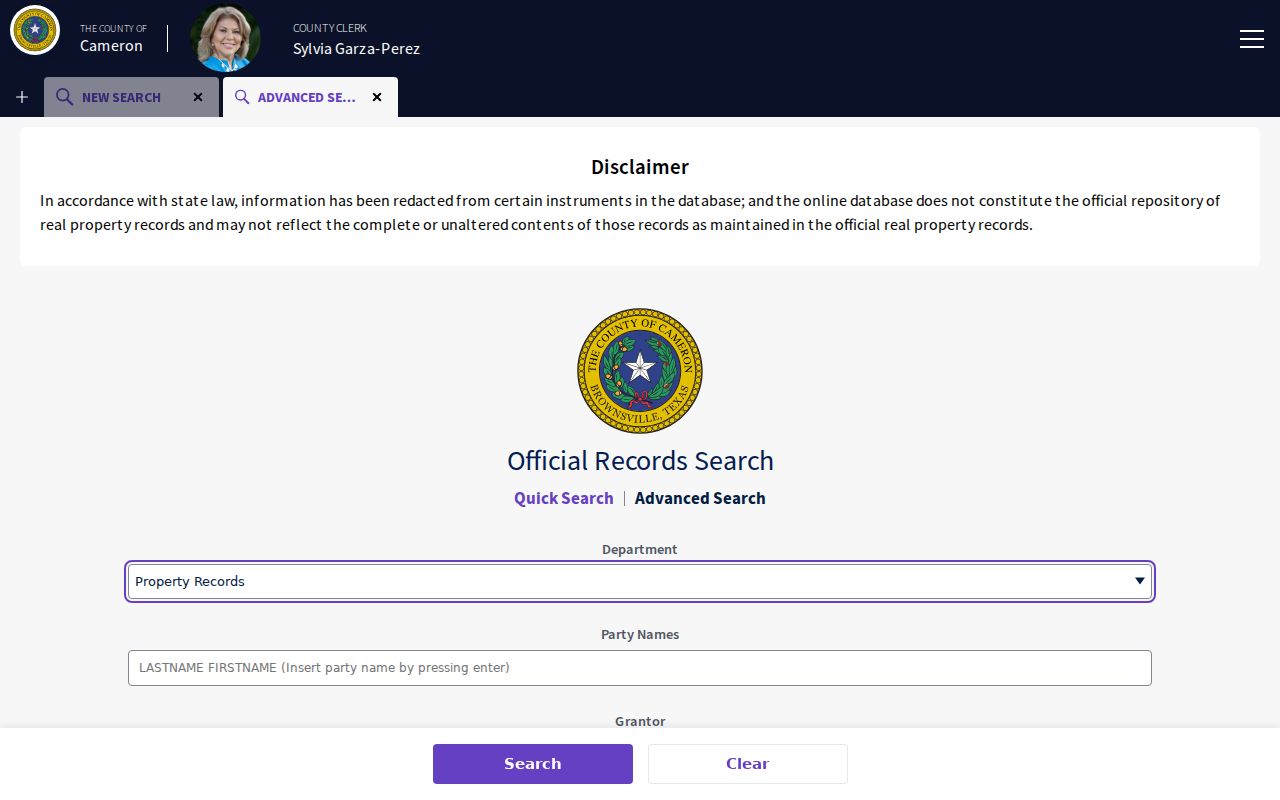
Use those fields to locate the recorded instrument that explains a parcel’s legal description, then compare the image with the index result.
Follow Cameron County Street Deeds
A deed chain is a sequence of recorded transfers, not a list of people who live along a street. Begin with CAD’s legal description and the most recent grantee, then read the earlier document for its prior grantor and recording information. Search the former grantee as a grantor on the next step back. Instrument date and recorded date belong in separate notes because they can differ.
Stop and verify if an instrument transfers a fractional interest, life estate, mineral interest, easement, or undivided interest. A plat may show how lots were created; a release may explain financing; a correction deed can repair a prior description; probate or an affidavit can explain a new party name. These documents help explain the chain without turning a street search into a claim about present residency.
- Parcel
- A defined piece of land represented in the appraisal and map systems.
- Situs address
- The property-location address used in an appraisal or mapping record, which can differ from a mailing address.
- Plat
- A recorded map that lays out a subdivision, lots, blocks, or easements.
- Criss-cross directory
- A directory section that moves between an address and a name, often useful for dated historical research.
The current Cameron official-records index is the modern entry point for grantor, grantee, subdivision, document-type, and document-number searching.
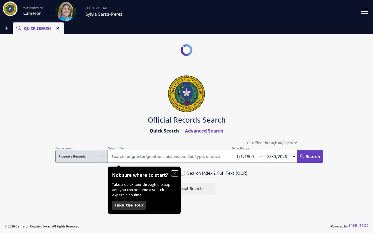
The index provides the record trail; the legal description and recording reference should be carried forward to the next document.
Historic Cameron County Street Clues
The historic Cameron County clerk index is a separate address-research channel. Its deed books cover 1830 through 1968, with historic index books reaching 1830 through 1957 and other historic record groupings. Older street numbers should be searched with the legal description, book or volume and page, and party names. The county’s deed records begin in 1848, but deed Volumes C and D covering August 14, 1850 through February 6, 1851 were destroyed in the 1854 fire. That gap is part of the record history, not evidence that a person or parcel never existed.
Search spelling variants and older subdivision labels. Later deeds, tax records, probate, court minutes, newspapers, and archival records can sometimes reconstruct parts of a broken trail. Mark the source and date beside each historic address rather than silently converting it to a current street label.
The historic Cameron County deed index provides the year, party, and book-volume-page route for older recorded material.
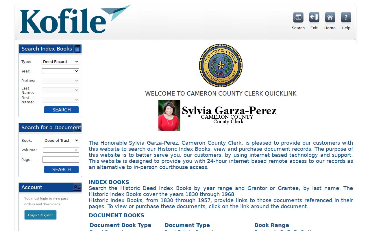
Use a historic index reference with the present legal description, then state clearly where a damaged or unindexed series breaks the chain.
Note: A historic address listing is dated evidence, so record its publication or recording year before comparing it with current CAD data.
Cameron County E911 Address Checks
Emergency and postal addresses serve different systems. Cameron County Emergency Communication District 9-1-1 assigns E911 addresses for most unincorporated and incorporated areas and can help when city-limit status is uncertain. For an existing structure, request address verification or confirmation rather than assuming that the address on a delivery label is its E911 address. The new-address office is listed at 501 Camelot Drive, Harlingen, TX 78550, with (956) 425-1911 as the new-address contact.
The Cameron County E911 request form asks for the requester and owner, subdivision, lot and block, property-tax account, and directions. For a subdivision request, assemble the phase, lot or block, CAD property ID, tax account, and clear directions before contacting the office. The form’s fields show why a postal place alone cannot settle a street-directory question.
Harlingen Street Names in Cameron County
Street names are time-sensitive evidence in the Cameron County street directory. Harlingen history identifies Main Street as today’s Jackson Street, and archival research documents the current Harlingen street-name and number system from 1926. A result in an older directory may therefore use a valid historic label that does not appear on a current map. Test the old name against dated maps, directories, the legal description, and the parcel record before treating it as an error.
Harlingen’s Article V street-naming process also uses the CAD ad valorem tax rolls to define a property owner for an application. That administrative definition should not be confused with proof of a present household. It is one more reason to keep a street label, a CAD owner label, and a recorded grantee in separate columns.
Cameron County GIS for Street Context
The Cameron CAD GIS viewer provides the map context for a street directory search. Use it to orient a parcel, road, adjacent geometry, and jurisdiction layer, then return to CAD and the clerk for the fields that identify a recorded interest. Map scale and data date should be noted when a boundary or road alignment affects the conclusion. GIS is location evidence, not a source of title or a complete household list.
The Cameron County CAD GIS viewer is the map-focused companion to the parcel search.

Compare the map’s parcel shape with the PID, GEO ID, and legal description before assigning an instrument to the address.
Cameron County Street Directory Limits
A Cameron County street directory cannot reliably identify every person at an address. CAD labels are appraisal information. A recorded grantee may be a former owner, lender, trustee, or fiduciary. A mailing address may differ from the situs address, and a directory entry only supports the year in which it was published. Texas Public Information Act access under Government Code Chapter 552 remains subject to exceptions, redactions, seals, and confidentiality rules.
Privacy boundary. Texas Address Confidentiality Program protections, Election Code suppression, and other statutory exceptions can limit address access. Use official records for lawful personal research only, and never use an address trail to stalk, harass, intimidate, or harm anyone.
When the available records conflict, retain each role and date instead of choosing the most convenient name. That is more accurate and safer for residents.