
Cameron County Previous Residents Sources
House history moves backward best when each source has a clear job. Cameron CAD provides the current address, PID or GEO ID, and the exact legal description. The County Clerk index supplies recorded instruments and the parties named in them. Historic books, directories, newspapers, maps, and archival microfilm add context for different eras. Use the period covered by a source as a boundary, not as a promise that a name or address will appear.
| Source | Years It Covers | Where Held | What It Shows |
|---|---|---|---|
| Cameron County Clerk current official records | Current portal, exact online start not displayed | Cameron County Clerk official-records portal | Recorded instruments, parties, document number, book/page, legal description |
| Historic Cameron deed-index books | 1830-1968 | Historic Kofile portal | Older deed-index route by party and book, volume, or page |
| Other historic index books | 1830-1957 | Historic Kofile portal | Historic record groups with separate coverage |
| TSLAC Cameron deed records | Begin 1848; C/D gap Aug. 14, 1850-Feb. 6, 1851 | TSLAC local-records guide and microfilm | Early land trail and the documented destroyed-volume gap |
| Brownsville and Harlingen directories | Selected years from 1938-1982 | TSLAC, cited Wilmot evidence, and library routes | Dated name, street, household, or business lead |
| Sanborn maps | Brownsville 1894, 1906, 1914; Harlingen 1919, 1925, 1929, 1950 | HABS/THC/NPS research context | Building footprint, use, and street context |
Begin with CAD for a modern address, then use the current clerk index. When the records become historical, preserve the legal description and move into the historic index or TSLAC route. Use directories and newspapers at each dated chain point to investigate people associated with an address.
Start a Cameron County House History
Copy the CAD address, PID or GEO ID, and legal description before searching a name. The legal description can retain a subdivision, lot, block, acreage, or metes-and-bounds wording after a street number changes. CAD is an appraisal record. It is a useful starting point, but it does not issue deeds or subdivision plats and is not proof of current title or occupancy.
Put the facts into a small evidence ledger: address as searched, PID or GEO ID, legal description, source URL, date consulted, and source type. That discipline helps distinguish an owner label from a recorded party or someone merely listed at an address.
Follow Cameron County Grantor Grantee Records
The chain starts with the present deed trail, not with a directory. Find the current owner or address lead in CAD, then locate the incoming recorded instrument through the County Clerk search. The grantee in that transaction received an interest. The prior grantee can become the next name to search as a grantor, which identifies an outgoing transfer. Record both the instrument date and the recording date. They can differ.
- Capture the CAD address, PID or GEO ID, and the full legal description exactly as displayed.
- Search the current owner as grantee in official records and identify the incoming deed or related instrument.
- Copy the grantor, grantee, instrument date, recording date, instrument number, book/page, document type, and legal description.
- Search that prior grantor as a grantee to locate the earlier acquisition, then repeat backward one transfer at a time.
- When the modern result ends, search the historic Kofile index and the TSLAC path with the same names, legal description, and book or page clues.
- Grantor
- The party transferring an interest in the recorded instrument.
- Grantee
- The party receiving that interest. A grantee is not automatically an occupant.
- Chain of title
- The linked sequence of recorded transfers for a property interest. It can contain gaps, fractions, or changes that need verification.
- Legal description
- The lot, block, subdivision, acreage, or metes-and-bounds wording used to identify land. It can be more stable than a changing street address.
Check plats, deed-of-trust records and releases, easements, correction deeds, probate or affidavits, foreclosures, and restrictive covenants as the names change. A transaction can involve a lender, trustee, fiduciary, or limited interest rather than a straightforward change in household.
Search the current party under both grantee and grantor roles. At every earlier link, test the prior grantee as a later grantor and the transferor as an earlier grantee, while keeping the legal description beside each result. Role-based searching catches transactions that a simple address search can miss.
Historic Cameron County Deed Index
The historic Kofile portal separates the older deed-index books, listed for 1830-1968, from other historic index books listed for 1830-1957. Do not treat the portal’s historic range as proof that every document image, name variant, or record group is online. The modern portal did not display an exact web start date during research, so older work should use the historic route deliberately rather than relying on the current search alone.
Open the Cameron historic deed-index portal when the chain needs a historical party, year, or book, volume, and page search.
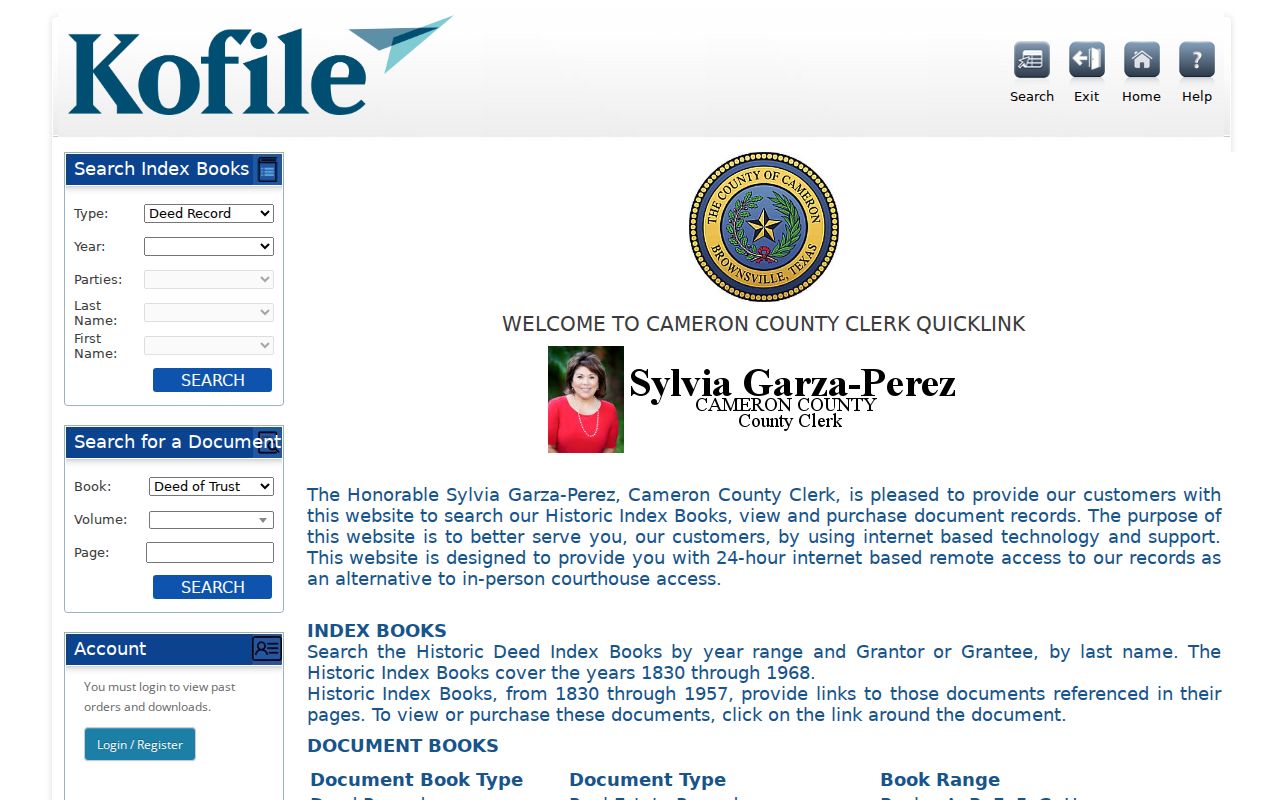
Carry forward the exact spelling, role, and locator from each result. A historic index points to the evidence; it does not establish that a named party lived at the property.
Cameron County 1854 Deed Gap
TSLAC says Cameron deed records begin in 1848, but Volumes C and D were destroyed in the 1854 fire. The lost span is August 14, 1850 through February 6, 1851. This is a documented gap in the chain, not a failed search or a reason to invent a transfer.
Make a known, destroyed, and reconstructed ledger for an early property. Later deeds may recite earlier ownership. Indexes, tax records, court minutes, newspapers, probate, and family records can provide supporting clues. Each reconstruction should state which source supplied it and leave the missing volume clearly marked.
Cameron County Old Street Numbers
Street labels can break an otherwise sound search. Harlingen’s current street-name and number system was documented as beginning in 1926, and local history identifies Main Street as the street now called Jackson Street. An old directory result that does not match a current map should be treated as time-specific, not discarded.
Search the prior number and the legal description in the historic index. Then compare the directory year, map, deed wording, and CAD situs field. A street number can change while the legal description stays stable. A parcel can also be split or recombined, so the same present address may not map neatly to an older property.
Previous Residents at Each Chain Point
Owners are only one part of the address history. At each dated transfer, test city directories and newspapers for a name or street reference. Use the Cameron County city directory collections for the specific Brownsville and Harlingen runs, publishers, and repository routes. Compare a directory year with a census year where household context is available, then follow with a deed, tax record, obituary, cemetery record, or probate file as appropriate.
Address and legal description → dated deed chain → directory or newspaper → household-level source → corroborating primary record. The match may show an owner, a listed person, a mailing address, a party to an instrument, or remain unknown. Use the role that the source actually supports.
- Criss-cross directory
- A directory section that moves from an address to a name, then lets the researcher return to name-based deed, tax, or court indexes.
- Enumeration district
- A census geography used to organize a count. It provides context for a census record but does not replace the address trail.
- Listed
- A careful label for a person appearing in a dated directory or newspaper. It is not a claim of continuous occupancy.
Lawful use. Cameron County previous-resident research belongs in house history, family history, estate work, and personal curiosity. Do not use a record trail to stalk, harass, track, or harm a living person.
Cameron County Official Record Search
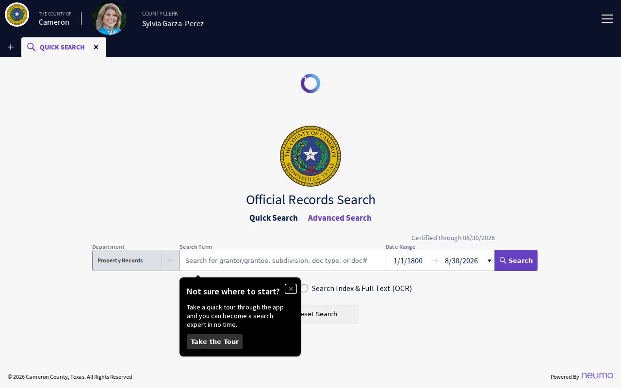
The County Clerk’s current portal supports a search term, recorded-date range, party names, separate grantor and grantee fields, instrument-date range, department, document type, document number, book, volume, page, lot, block, legal description, and OCR full text where available. Search the index before OCR. An exact person and role, a surname variant, a subdivision or plat, and a date band can each uncover a different link in the chain.
Use the Cameron County advanced official-records search to refine a historical property question after the legal description and names are known.
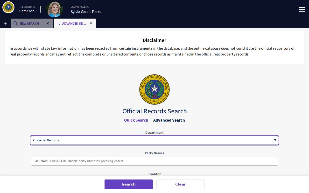
Save the recording number and both dates before opening or requesting an image. These details make the next historic-index or clerk request reproducible.
Cameron County Maps Add Context
Historic maps can explain the physical setting without naming everyone associated with it. Brownsville research cites Sanborn maps from 1894, 1906, and 1914. Harlingen research cites sheets from 1919, 1925, 1929, and 1950. They can show a building footprint, its use, and street context around the date of a directory or deed.
Do not use a map as occupancy proof. Compare it with the legal description, a dated directory or newspaper, and the recorded chain. Where sources disagree, retain every label with its date and source. The mismatch can reveal a renumbered street or a changed parcel.
Cameron County Archive Leads
TSLAC’s Cameron guide lists burial permits, cemetery records, civil minutes, deeds of trust, and other microfilm useful for testing a property or family lead. Brownsville Historical Association holds about 18,000 photographs, manuscripts, land grants, architectural drawings, newspapers, and property abstracts. Its collections are a place-history source when an address points to a building, civic event, or older business.
Visit the Cameron County Clerk official-records portal for the current index before turning to a repository collection.
BHA lists research hours Tuesday through Saturday, 10 to 4, at 1325 E. Washington in Brownsville. The association recovered 106 Chamber of Commerce boxes from roughly 80 years, with digitization ongoing, so ask about an item’s processing status and record any box or folder citation.
UTRGV Edinburg holds Cameron County microfilm listed by TSLAC. It can be a useful alternate repository for nineteenth- and early-twentieth-century death, birth, civil-minutes, deed-of-trust, burial-permit, and cemetery work. Confirm the reel and date span before treating an absence as meaningful.