
Cameron County Neighbor Block Records
The block around an address can be researched through several Cameron County record systems. Each sees a different layer. GIS puts a parcel in geographic context. CAD supplies appraisal and parcel keys. The County Clerk holds recorded instruments and legal descriptions. Historical directories can provide a dated lead, while the state association search can identify a community organization. None of these sources alone is a household roster. Label each finding as a parcel, owner, recorded party, historic listing, or association result.
| Source | What It Shows About a Block | Access |
|---|---|---|
| Cameron CAD GIS | Parcel and road-map context, nearby geometry, and jurisdictional layers | Public mapping route; not ownership proof |
| Cameron CAD | PID, GEO ID, situs address, owner label, legal description, and appraisal lead | Public dynamic property search |
| County Clerk official records | Grantor, grantee, recording details, and legal descriptions for parcel history | Public index; images or purchases may vary |
| Historic directories | Dated street or reverse-directory household and business leads | Repository or library access |
| Texas HOA certificates | Association name and community geography where the dynamic result provides it | Public state search; no resident roster |
Parcel neighbors are not necessarily household neighbors. An appraisal owner, tax recipient, occupant, recorded grantee, and mailing recipient can all differ. Do not infer who lives at an address from the map or an owner label alone.
Map Cameron County Neighbors by Parcel
Start from one complete street address and work outward only as far as the immediate surrounding parcels. Cameron CAD GIS is useful for locating roads and parcel shapes, but the research did not establish it as ownership evidence. The CAD property search supplies the PID, GEO ID, address, and owner-of-record appraisal label that make a nearby parcel distinguishable. When a precise ownership question remains, compare the legal description with a County Clerk recorded instrument.
- Enter the address in the GIS or CAD map route and confirm the street and parcel location.
- Identify the adjoining parcel labels and return to CAD with each address, PID, or GEO ID.
- Record the CAD owner label, situs address, and legal description as appraisal evidence.
- Use the County Clerk index to compare the legal description with a recorded deed or other instrument.
- Keep the recorded role separate from any question about occupants or current contact information.
The process is address → map context → adjacent parcel labels → CAD PID or GEO ID → legal description → recorded instrument. A named street needs a broader address trail, which the Cameron street directory handles without treating the entire street as one block.
Note: Map scale, data date, and parcel boundaries should be recorded before a Cameron neighbor lead is compared with another source.
Cameron County GIS Neighbor Context
County GIS and CAD mapping are best used for place, not proof of identity. A map layer may locate a road, parcel, or jurisdiction but can be incomplete or generalized. CAD’s own FAQ separates appraisal information from deeds and subdivision plats, which are routed to the County Clerk. That distinction matters on a Cameron block because parcel shape can remain stable while ownership, mailing details, or a household changes.
A Cameron CAD GIS viewer image shows the mapping route used for parcel context.

Use the map to establish the relationship among parcels, then use CAD and the clerk record to identify the record role. Do not describe a GIS view as proof of ownership or occupancy.
Cameron County Neighbor Lots First
Lot, block, subdivision, acreage, and metes-and-bounds language are often more stable than an address. CAD can show a legal description, and the County Clerk advanced official-records search accepts lot, block, legal description, book, volume, page, document number, recorded date, party names, grantor, grantee, and departments. Preserve the legal description exactly before searching for a deed, correction, plat, easement, release, affidavit, or probate record.
A recorded transfer can explain why names vary on nearby property. It can also show a lender, trustee, fiduciary, former owner, or a fractional interest rather than a current owner. When land has been split or recombined, the legal description and instrument dates can resolve whether two address labels refer to one parcel or different parcels.
- Parcel
- A mapped unit of land used in appraisal and mapping systems. Its boundaries or identifiers may change when land is divided or combined.
- Situs address
- The property location field used for a parcel. It is not necessarily a mailing address or a statement about who occupies the property.
- Plat
- A recorded map that describes how lots, blocks, or subdivisions were laid out. The clerk, not CAD, is the deed and plat source.
Brownsville GIS Neighbor Context
Brownsville GIS maps offer municipal layers for property addresses, voting districts, city facilities, and other civic geography. These layers can help distinguish a city facility, voting area, or address pattern from a county parcel question. They are not a deed source and should not replace CAD or the County Clerk when the issue is an owner or a legal description.
Use the city layer only to add geographic context to Cameron neighbors. A voting district or city-facility layer can explain where a block sits, but it does not identify a household, establish continuous residence, or create a complete list of people nearby.
Cameron County Neighbor Associations
The Texas management-certificate search can help identify an association connected to a Cameron County community. Its Cameron County filter is dynamic, so results should be checked live. A management certificate identifies an association name and community geography where the database returns those fields. It does not provide a resident roster, a complete contact list, or a reason to collect names from a block.
| Official route | Texas HOA management certificates, Cameron filter |
|---|---|
| Useful result | Association identity and community-geography lead when the live search provides it. |
| Not supplied | A resident directory, a household roster, or proof that a person is a current neighbor. |
| Follow-up | Confirm the community connection through a parcel legal description or an official recorded instrument. |
The official certificate search image shows the county-filtered access route.
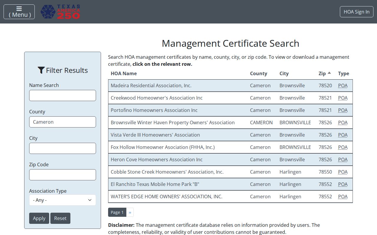
Because the results are dynamic, do not assume a search screen proves that an association manages every nearby parcel. Check the current record and the parcel’s legal description.
Cameron County Neighbor History Dates
Historical directories can show how a block was described at publication, especially when an address or a local institution is being traced over time. The 1939 Harlingen Wilmot directory gives a useful downtown example: the Baxter Building grouped 17 medical professionals, five insurance companies, and 18 businesses. That concentration is a historical business-block snapshot, not a list of current Cameron neighbors or a claim that every person listed lived there.
For historic work, record the directory title, publisher, year, page, street or reverse-directory entry, and repository. Compare the dated listing with a deed, tax record, newspaper, obituary, or other independent record. The county includes many postal communities, so keep the city or postal place in the citation rather than flattening every result to Brownsville.
Note: A directory’s publication year describes a historical lead and cannot establish present-day residence on the block.
Cameron County Neighbor Roles Differ
A careful neighbor lookup separates owner, tax recipient, occupant, grantee, party, and registrant. CAD gives an appraisal owner label. A recorded deed identifies grantor and grantee roles. A directory provides a dated listing. A voter result offers a registration or status clue subject to state confidentiality rules. Each is useful in its lane. None should be relabeled as a current household without a second source that supports that conclusion.
| Official records | Commercial neighbor tools | Practical difference |
|---|---|---|
| Show source-specific roles and dated custodian records | Combine public and brokered data into reports | Read the source and date before accepting a relationship |
| Offer custodian-specific correction or access routes | May retain an outdated report after source records change | Correct an error with the source that created the record |
| Carry statutory redactions and confidentiality limits | Cannot override protected-address rules | Do not use a republished entry to work around suppression |
Texas privacy protections apply even when a public record has been copied elsewhere. The appropriate comparison is between the original record’s role and a separate, corroborating record, not between an address and an assumption about a person.
Cameron County Neighbor Voter Limits
VoteTexas allows a voter to check registration or polling information with name, Cameron County, date of birth, and ZIP. It should not be used to build a block roster. Texas makes some voter information public, but Social Security numbers, driver-license numbers, personal-ID numbers, and protected information remain confidential. Voter residence addresses may be suppressed, and current records can be stale.
Cameron County’s 2024 countywide model used 68 Election Day locations. The election-specific location may not be the closest place on a block, and it says nothing about who lives nearby. Use the Cameron Elections office for precinct maps and notices, then leave protected information out of notes.
Cameron County Neighbor Lookup Limits
Texas access rules do not turn an address into permission to locate a household. Government Code Chapter 552 includes confidential and redacted material, and Government Code §552.117 covers certain public employees, peace officers, and other protected categories. Election protections also apply. A person may request voter-website residence suppression while records remain subject to the public-information framework and other statutory rules.
The Texas Address Confidentiality Program gives qualifying victims a substitute box and forwarding service. It serves victims of family violence, sexual assault, human trafficking, stalking, and child abduction who meet the program’s requirements. Certification lasts three years and is renewable. Do not reverse-locate a participant, search around a protected address, or treat an absent result as an invitation to seek personal details elsewhere.
Lawful use. Use Cameron neighbor records for narrow, personal, lawful research. Do not use an address, parcel, association, or voter result to stalk, harass, threaten, dox, or intimidate anyone.